Safe Drinking Water in the Backcountry, Part 2: Filtration

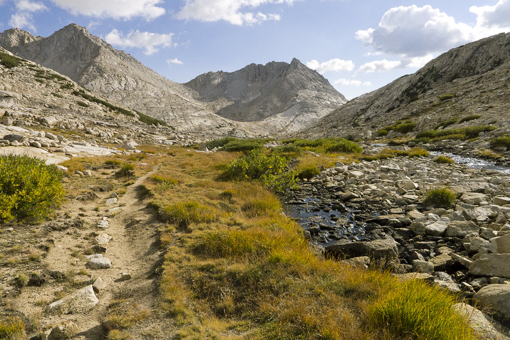
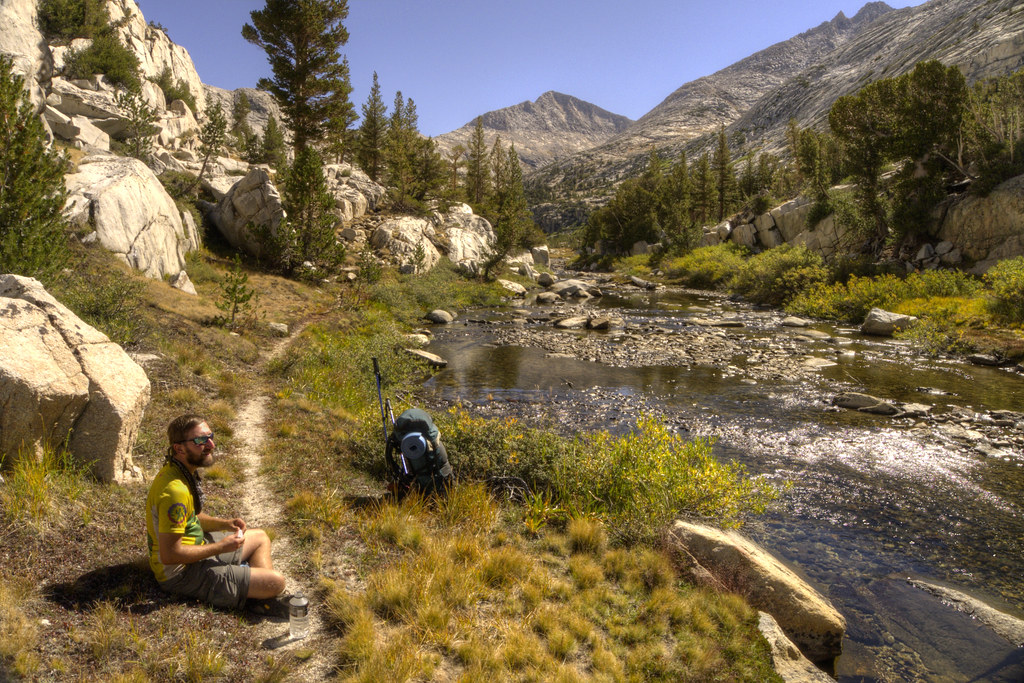
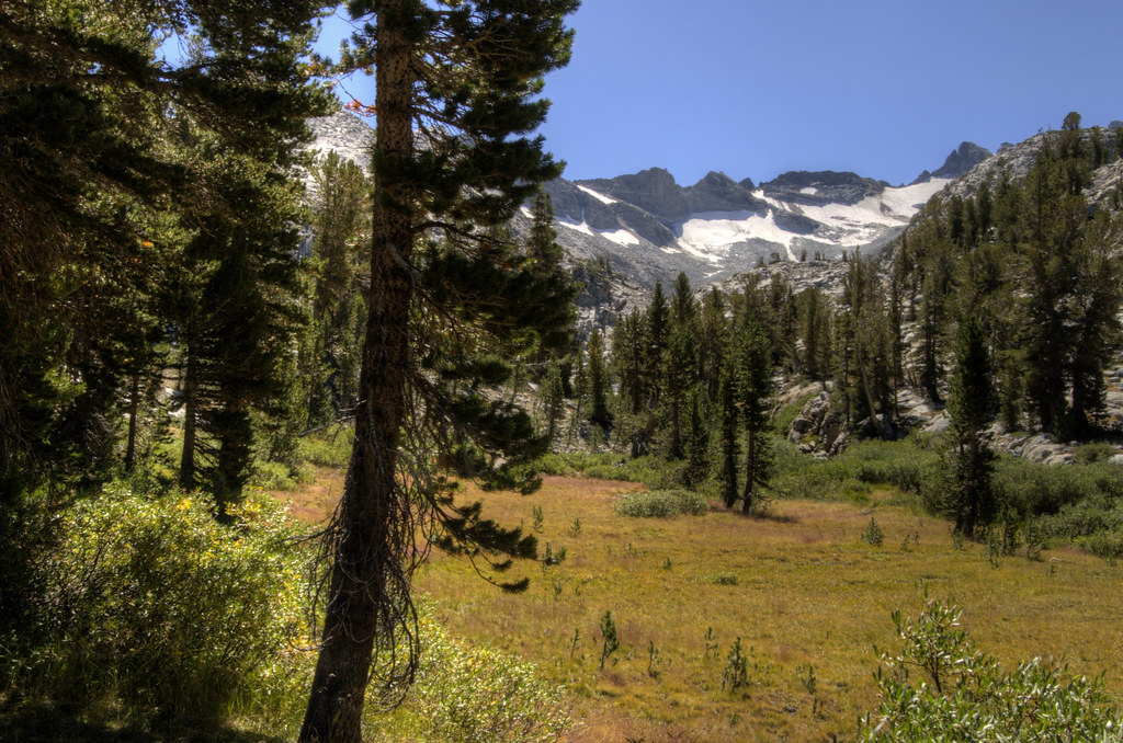
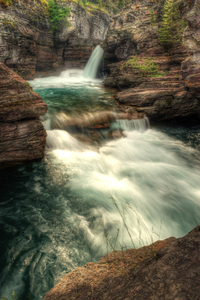
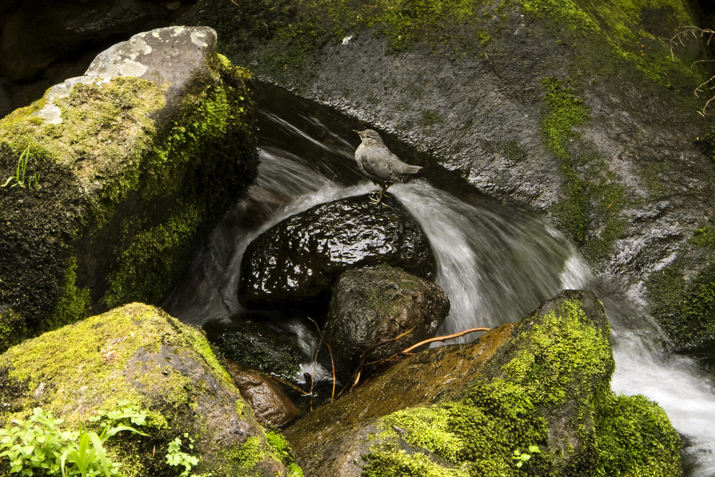
Saint Mary Falls, Glacier National Park
In my previous post on using bleach to treat water in the backcountry, I said my method for treating water is a combination of household bleach and an inline filter. You might be wondering why I would use both. Especially since most people only use one or the other and some don't treat their water at all... read more >

If I was only going to take one treatment method, it would be a .1 micron inline or straw filter every time, but below are good arguments for carrying both.
  1. It's good to have a backup method... read more >
  2. Filters allow me to drink up at the source and carry less... read more >
  3. An eyedropper of bleach only weighs 1 ounce, so even though I prefer an inline or straw filter, 1 ounce isn't a noticeable addition to my pack.
  4. Filters, unlike any chemical treatment, are very effective at removing Cryptosporidium and Giardia, the two most common water-born illnesses in American backcountry... read more >
  5. Bleach is very effective at removing viruses and bacteria, filters are not... read more >
  6. Bleach can be used to sterilize my toothbrush and eating utensil... read more >
  7. Filters improve taste... read more >
My preferred filter:

Sawyer Squeeze Filter
With the variety of filters on the market, I haven't found a good reason to continue using my traditional pump-style filter. If I can help it, I'd rather not get down on my knees, dangle a filter hose in water, and pump it into a bottle. I prefer inline or straw filters.

4-Way Filter Bottle
Rather than pump water through the filter, an inline or straw filter uses your suction to filter as you sip. You can just scoop and go, without having to take off your pack. And to fill a cook pot, you can use gravity or squeeze the water from the pouch or bottle.

When on a trail with plenty of water sources, it's not inconvenient to get water, so I don't carry around as much water weight. In addition, the inline filters themselves are also lighter than a pump filter. My favorite inline/straw filter is the Sawyer Squeeze Filter or the Sawyer 4-Way Filter Bottle. Here is why:
  1. They have a .1 micron filter... read more >
  2. Multiple ways to use... read more >
  3. Easy to use... read more >
  4. Small and Lightweight. The Squeeze filter with a pouch weighs about 3 ounces, the 4-Way Bottle, about 5.
  5. Sawyer has a one million gallon guarantee!... read more >
  6. Easy to clean/backwash... read more >
  7. Cons, because there is always one, right?... read more >
At the time of this post, Amazon is selling the Sawyer Squeeze Water Filter for $42.38 (Click here to order or read more reviews). For that price, you will get: three lightweight collapsible pouches (0.5 L , 1 L, and 2 L pouch), Sawyer 0.10 Absolute Micron Hollow Fiber Membrane Screw On/Off Water Filter, Replaceable Pop Up Drinking Spout, Cleaning Syringe, and the 1 Million Gallons Guarantee.

The 4-Way Filter Bottle is currently $36.86 at Amazon (Click here to order or read more reviews). For that price, you will get: a 1L water bottle, Sawyer 0.10 Absolute Micron Hollow Fiber Filter, faucet attachment for backwashing, extra straws, hose adapter for hydration bladders, and the 1 Million Gallons Guarantee.

See the Sawyer Squeeze Filter in action:

See the Sawyer 4-Way Filter Bottle in action:


More water related information:

Why I don't use Sterilizing Pens... read more >
 
How much water to carry... read more >

Using Bleach To Treat Water in the Backcountry... read more >
Why I use plastic soda or water bottles... read more >

Safe Drinking Water in the Backcountry, Part 1: Using Bleach

Click here to skip right to my method for treating water in the backcountry with household bleach. If you're like me, you hate reading through a lot of unnecessary paragraphs when you're looking for specific information, and I can be unnecessarily long-winded. Here's proof...
- - - 
As many of you know, this blog has primarily been a place to share stories and photos from my trips, but my next trip won’t be for at least a couple months. So until that time comes, my blog will be more of a practical guide to backpacking. Or with the direction my life has taken, a practical guide for the deliberately homeless.

Either way, I've learned a lot from my experiences and I love to chat about this stuff. I get a lot of questions and could spend hours answering them, as many unfortunate people have realized after asking me a seemingly simple question.

Many of the questions I get involve obtaining safe drinking water in the backcountry. When I tell people I use common household bleach, they often look at me like I have a death wish. So that's where I'll start.

Few things are as refreshing as drinking all-natural water straight from a cold mountain stream, untainted by chemical treatments. Or to just plunge your face into a spring on a hot day and quench your thirst without fussing around with filters, pumps, and hoses.

If you are smart about choosing your water source, you could go for days, weeks, or even years without treating your water and never get sick. It's a gamble, but after spending a few days stepping over moose poop, or seeing a bloated dead animal floating in a water source, or worse yet, having to witness your friend doubled over with stomach pains and running off into the trees to decorate that beautiful foliage in vomit or explosive diarrhea... I'm getting a bit off the rails here... what I'm trying to say is, that stuff kind of diminishes the "all-natural" romanticism of drinking from a cold mountain stream. So, I treat my water.

Everyone has their own preferred method, but here’s what I do:

My Water Treatment Method:
My method for treating drinking water in the backcountry is a combination of household bleach (one drop per 16 oz.) and/or an inline or straw filter. And don't forget the often skipped step of cleaning your hands after touching potentially contaminated water. I carry a small bottle of hand sanitizer for this. Not doing so could negate everything you do to treat your water.

First, I should say that nothing is more effective as boiling to treat water in the backcountry. Boiling water vigorously for 60 seconds, or three minutes at altitudes higher than 6,500 feet, will kill everything. No other safe chemical or filtration method can claim that. If you're already boiling water for cooking, it's great. For drinking water, however, it is perhaps the most impractical method... read more >
.
Why I use bleach:
1. It's safe... read more >
2. It's effective... read more >
3. It's cheap... read more >
4. It's easy to find... read more >
5. It's lightweight... read more >
How I use bleach:

My method is based on recommendations by the Centers for Disease Control, the American Red Cross, and hours of additional reading. If you find any mistakes or have questions or suggestions, please contact me at grayson.ryan@gmail.com. I will always be happy to learn something new and will update this information accordingly.
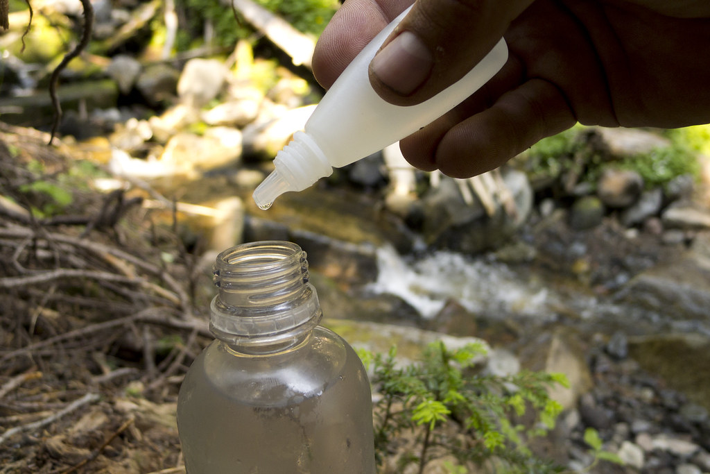
1. Fill an eyedropper with bleach.
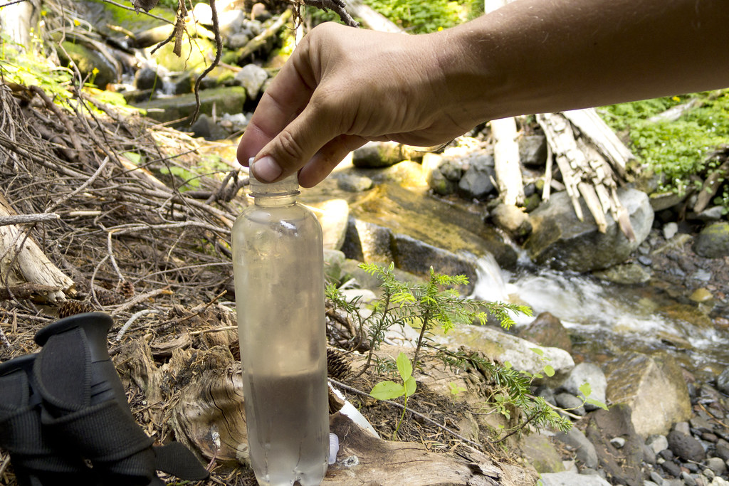
Before heading out, I fill an eyedropper bottle with common household bleach. I use an old Visine bottle or breath drops bottle. Since bleach will degrade in direct UV light and become less effective, consider covering the bottle in duct tape, or paint, or something.

To fill the bottle without spilling bleach, I often use a ZipLoc bag as a funnel. Put the desired amount of bleach in the bag. Hold it by one of the top corners, so one of the bottom corners is above the bleach. Cut a tiny bit of the corners off, then tip the bag and pour the thin stream of bleach into the dropper bottle.

I keep the bottle in a ZipLoc freezer bag or in an empty wide-mouth Gatorade or Powerade bottle to prevent damage to gear and clothes. So far, I have not had a problem.

Also, keep in mind, the decomposition rate of bleach increases by a factor of 3.5 for every 18° F increase in temperature, so if not stored at 60-80 degrees, it's probably a good idea to dump it out and replace it after a couple weeks to be safe.
2. Fill your water bottle with water.

The best water source is actually the top few inches of lake water. The longer time under the sun’s UV rays does a lot of the sterilization for you. Otherwise, a spring or swift moving creek will be fine.

If the water source is not clear, I tie a bandanna around the top of my bottle when filling. If your water is still cloudy, let it sit until all sediment has settled, then pour the clear water into another bottle before treating. Chemical treatments are much less effective if the water is not clear or contains free-floating organic material. Organisms that are clinging to free-floating particles are harder to kill.
3. Add one drop of bleach per 16 oz. of clear water.

Use two drops if the water is really cold, cloudy, or discolored. If your bleach is not the common 4-6% solution of sodium hydrochlorite you may have to use more or less. The amount of sodium hypochlorite added to bleach may depend on the season. More may be added in the summer to compensate for the higher temperatures. It could be as high as 10%, so check your bleach bottle’s label and adjust dosage accordingly.
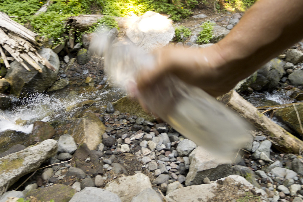
4. Shake it like a Polaroid. 
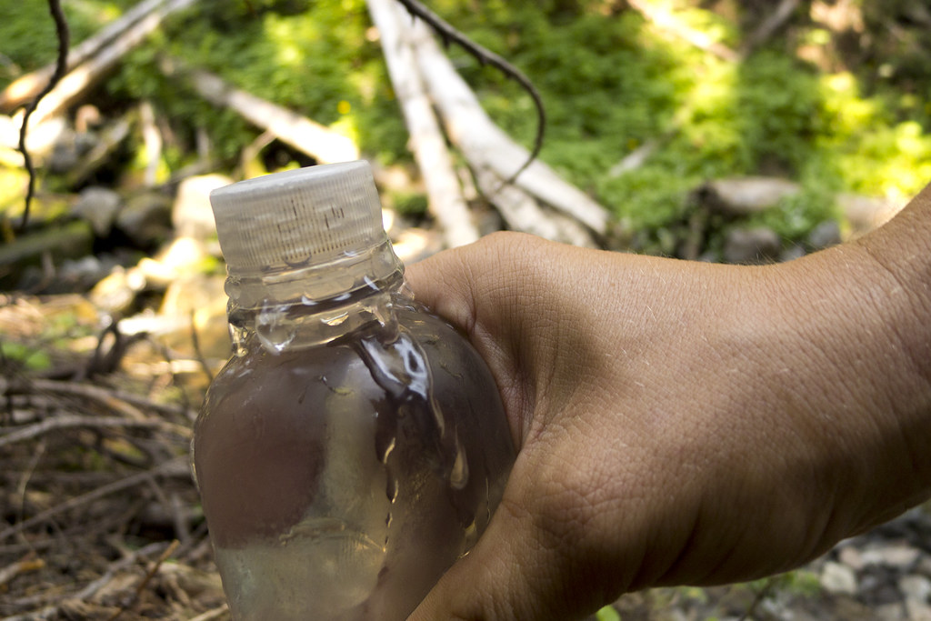
5. Screw the cap nearly all the way on, then squeeze the bottle until it starts to pour out, and then tighten the lid.

This ensures that the entire bottle, including the cap and threads, get disinfected.
6. Wait 30 minutes. And in the meantime, clean your hands with a hand sanitizer. Not cleaning your hands after touching a contaminated water source could negate everything you have done to prevent a water-borne illness.

If after 30 minutes, your water does not have a slight chlorine smell similar to municipal tap water, repeat steps 3 through 5. Think of bleach as an army of soldiers you're sending into battle. They kill organisms, but die in the process. The more organisms there are to kill, the more soldiers you need. That's why it may be necessary to treat a second time. And why sometimes you'll smell or taste more chlorine than other times. Keep in mind though, this isn't the fault of bleach alone. It's true for any chemical treatment.


More water related information:

Why I don't use Sterilizing Pens... read more >
 
How much water to carry... read more >

Using Filters To Treat Water in the Backcountry... read more >
Why I use plastic soda or water bottles... read more >

Sixteen Months of Wandering

It has been less than a year and a half, but every day it gets a little harder to picture how my day-to-day life used to look. It’s like trying to recall a face I haven’t seen in years that I used to see every day. I close my eyes, but can’t quite get a clear image.

Used to be, a year and a half would pass by frighteningly fast, but life doesn't seem as short anymore. I credit that to doing more in 16 months than all my previous years combined.

I backpacked through 3,000 miles of wilderness and the occasional small mountain town. That's over six million footsteps with nothing but the bare essentials on my back. These trails had a cumulative elevation gain of more than 675,000 feet or 130 miles, twice the distance to outer space, or more than the height of 23 Mount Everests.

I'm not sure which has received more wear-and-tear though, me or my worn-out Honda Civic. It racked up 26,000 miles on American highways since March of this year. The car is one of the few things in my life that hasn't changed, although we are much more acquainted now.

If you haven't read every post on my blog, here's what I've been up to. On June 10, 2011, I quit my job, packed a backpack, left everything else behind, and then....

  • Hopped on a train to Washington D.C.
  • Saw the Smithsonian, the Jefferson Memorial, Lincoln Memorial, Washington Memorial, the White House, the Library of Congress, the Capitol building, The Constitution, Declaration of Independence, and every other D.C. monument, artifact, and museum on my life list
  • Stayed in the first of many hostels and met people from all walks of life
  • Took a bus to New York City
  • Roamed aimlessly around Time Square and Broadway
  • Heard a never publicly performed piece of music played by a symphony in Central Park
  • Got lost in Central Park at night. It took a few hours to find my way, but after thinking about my upcoming hike from Maine to Georgia, you can rest assured, I fully appreciated the dramatic irony.
  • Then, at two in the morning, I went to the top of the Empire State Building to see the lights and bustle of the city that never sleeps
  • The next day, I took the subway to Ground Zero
  • Saw the Statue of Liberty from the Staten Island Ferry
  • Unexpectedly witnessed Will Smith filming Men in Black 3 in Battery Park
  • Strolled down the "pre-occupied" Wall Street
  • Walked to Brooklyn on the Brooklyn Bridge
  • Watched a taping of the Late Show with David Letterman, with Eddie Vedder and Cameron Diaz
  • Took a train to Boston
  • Walked the Freedom Trail and saw every historical site I know of in Boston, and some I didn't know of
  • Bought tickets from a scalper in Fenway Park and watched a Red Sox Game
  • From my stadium seat, sang Sweet Caroline and yelled YOUUKK!, without understanding why
  • Helped a schizophrenic homeless man update his blog (I always knew I would someday)
  • Took a bus to Maine
  • Met my new friend Erik (a.k.a Red)
  • Hiked the 2,181-mile Appalachian Trail from Maine to Georgia, through 14 states. On the trail I...
  • Met Sam and Liv (a.k.a. Bambi and Thumper), who became my favorite people in the world
  • Backpacked through the Hundred Mile Wilderness in Maine
  • Hitchhiked for the first time
  • Spent the night behind an abandoned bank, a city park dugout, and many other random places like a hobo
  • Backpacked through the White Mountains in New Hampshire
  • And the Green Mountains in Vermont
  • Hiked through Hurricane Irene and Tropical Storm Lee
  • Had lots of fun in random mountain towns drinking with trail friends
  • Hiked along the Housatonic River through Massachusetts and Connecticut
  • Then through New York, New Jersey, Pennsylvania, and Maryland
  • Slept under Jefferson Rock National Historic Landmark in West Virginia
  • Met my new friend Gregg (a.k.a Lightfoot)
  • Backpacked the length of Virginia's Shenandoah National Park during the peak of fall colors
  • And in the snow in Tenneesee and North Carolina's Great Smoky Mountains
  • Encountered several black bears, a wild boar, and interesting mountain people
  • Fell in love with a new and exciting way of life
  • And a girl
  • Reached the AT's southern terminus in Georgia 183 days after leaving the northern terminus
  • I went back home for the holidays and recovered from injuries
  • Then I went to Kentucky to visit Sam and Liv on their family farm
  • I was lucky enough to convince Liv to quit her job and go on an 8,200-mile road trip on old Route 66 from Chicago to Santa Monica, California. After an early morning start on March 3rd we...
  • Toured Chicago, Illinois
  • Visited Lincoln’s Tomb and the Lincoln Home National Historic Site
  • Accidentally went into a gay bar in Springfield, Illinois
  • Saw numerous aging roadside statues, attractions, and museums
  • Played legendary games of pool in the bars of Tulsa, Oklahoma with a level of skill that we have never been able to repeat
  • Trespassed on private property, so we could sleep in an 80-foot concrete blue whale in Catoosa, Oklahoma
  • Hiked into Palo Duro Canyon, the second largest canyon in the United States, near Amarillo, Texas
  • Found Billy the Kid's Grave
  • But found no aliens while in Roswell, New Mexico
  • Sled down bright white gypsum sand dunes in Southern New Mexico's White Sands National Monument
  • Tossed a football on a vacant desert road in Southern New Mexico, and car camped under a dark starry sky
  • Explored the caves of Carlsbad Caverns National Park
  • Had to deal with the exhaust pipe falling off the car in a New Mexico ghost town in the middle of the night
  • Found a saloon next to a mechanic's shop in Magdelina, New Mexico who we hoped could fix it, so we played pool, drank beer all night, and then slept in the car. 
  • Drove with a loud muffler-less car to the Very Large Array Radio Telescopes near Socorro, New Mexico
  • Stared out into Arizona’s Painted Desert National Park
  • Hiked in Arizona's Petrified Forest National Park
  • Climbed a volcanic crater in Arizona’s Sunset Crater Volcano National Monument
  • Saw ancient ruins at the Wupatki Monument in Arizona
  • Watched the sunset while driving through the Mojave Desert in Southern California
  • Peered into the deep and magnificent Grand Canyon
  • Listened to Grand Canyon tourists mutter about "that crazy girl" (Liv) boulder scrambling so I could get a better picture of her
  • Lived in our car for a couple days in Southern California’s Slab City
  • Drove many miles in silence while Liv concentrated on writing an epic poem about the trip
  • Hiked around Joshua Tree National Park and climbed a mountain named Ryan
  • Arrived at the end of Route 66 on the Santa Monica Pier
  • Drove up the Pacific Coast Highway
  • Walked along the Pacific Ocean in Big Sur State Park
  • Had dinner with Liv’s sister in Monterrey, California who she hadn't seen in two years
  • Hiked on 3 feet of snow to see the world’s largest tree in California’s Sequoia National Park
  • And more giant trees in Kings Canyon National Park
  • Sat on the ground at the lowest point in North America, 282 feet below sea level, in California’s Death Valley National Park
  • Backpacked in Utah’s Zion National Park and woke up with snow on our tents
  • Nervously watched Liv climb up rocks in Southern Utah’s Capitol Reef National Park without a rope, and had to have her rescue me when I got stuck in a “pothole”
  • Saw the rock formations in Utah’s Arches National Park
  • Then watched the sun set in Canyonlands National Park
  • Toured ancient cliff dwellings in Colorado’s Mesa Verde National Park
  • Climbed sand dunes in Colorado’s Great Sands National Park
  • Then, after regretfully taking Liv back home in Kentucky, I picked up my AT friend Red to hike Vermont’s 273-mile Long Trail, from Massachusetts to Canada. 
  • But first I spent a few days in New York City to meet Red's friends and family 
  • Took a tour of Long Island's wine country
  • Then headed to the southern terminus of the Long Trail
  • Slept in stranger's homes and a college "social house" during pledge week, to get out of bad weather
  • Got a free night's stay and a steak dinner at a fancy lodge
  • Spent the night on a Big Lots department store loading dock
  • Arrived at the northern terminus of the Long Trail and stepped into Canada
  • Took Red home and went to visit Sam and Liv in Kentucky again, the closest thing to home these days
  • Backpacked in Kentucky’s Red River Gorge
  • Then my second westward road trip began
  • I camped at Badlands National Park in South Dakota
  • Hiked around Devil’s Tower in Wyoming
  • Backpacked for five days along the Teton Crest Trail in Wyoming’s Great Teton National Park
  • Saw Old Faithful, the Grand Prismatic Spring, and many other amazing natural wonders in Wyoming’s Yellowstone National Park
  • Backpacked a 75-mile loop in Montana’s Glacier National Park
  • Circumnavigated Washington’s Mount Rainier on the 93-mile Wonderland Trail
  • Climbed Garfield Peak for a bird’s eye view of Oregon’s Crater Lake
  • Drove down the northern half of the Pacific Coast Highway that Liv and I didn't get to see
  • Hiked while staring up at the towering trees in California’s Redwood National Park
  • Cruised down the “Avenue of Giants” in Humboldt Redwoods State Park
  • Watched Pacific Ocean waves crash on several beaches along the highway
  • Drove over the Golden Gate Bridge in San Francisco, California
  • Visited Port Reyes National Seashore in California
  • Thru-hiked the 219-mile John Muir Trail. On that Trail, I....
  • Backpacked through Yosemite National Park
  • Sat by a campfire with a backdrop of a moonlit Half Dome
  • Then backpacked through Tuolumne Meadows
  • Then the Ansel Adams Wilderness
  • The John Muir Wilderness
  • And alongside Devil's Postpile National Monument
  • Got to hike with my AT friend, Lightfoot, again
  • Took a 30-mile side trip over Italy Pass to resupply in Bishop, California
  • Then backpacked through Kings Canyon National Park
  • And Sequoia National Park
  • Climbed above treelines and over mountain passes
  • Sometimes while the sun was setting
  • Once while lightning streaked through a dark anvil shaped storm cloud
  • Was brought nearly to tears from another mountain view
  • Never got tired of the miles or sleeping on the dirt
  • Summited Mount Whitney, the highest mountain in the Contiguous United States
  • Hitchhiked, for the couple-hundredth time, back to my car
  • On my drive back I stopped to see friends I wish I could see more often, then went back to see the girls in Kentucky, and family in Indiana
  • And finally… spent many nights wondering how I could ever go back to that old day-to-day life ever again
I experienced a lot in these sixteen months, but also learned a lot. About myself and about the country I call home. I didn't always like what I learned about myself, but the country never disappointed. People have asked me if I plan on venturing outside of the United States on my future trips. And I do, but I'm glad I took the time to see America first. Knowing what I know now, I'm relieved that I didn't let my life go by without seeing it up close, slowly and on foot. The only way to really see anything. 

I thought I knew the country before leaving home last year, but I really didn't. I know now that it is beautiful beyond imagination. And even though bad things occasionally happen, its citizens are overwhelmingly good and caring. The number of people who went out of their way to lend a hand, a ride, a home, or home-cooked meal, were too numerous to count. They were people that knew nothing of me other than I was dirty, smelly, unshaven, and probably hungry or tired. And it seemed that the less they had, the more they wanted to help.

Ignore the news. Ignore the partisan politicians that get us worked up over nothing like they’re starving pit bulls just to win a dogfight. Ignore people that want us to believe we are divided. I learned that my favorite people and places align with me the least politically, scientifically, or religiously.

Ignore overzealous preachers and doomsayers. Our country is far from evil. I have to believe that anyone who believes it is has not made much of an effort to really see it. Other than on a television screen, which is a lot like listening to a symphony on blown-out cellphone speakers then believing music is a dreadful thing.

I've learned a few other things in these sixteen months. I know that I don't need much to be happy. I could lose all my possessions and be alright, and possibly happier because of it. And I learned that no matter how many unknowns my future holds, or how daunting something can be, I know I can get through it and come out just fine on the other side.

Perhaps the biggest lesson I learned in these sixteen months, is that you have to follow your bliss, whatever it may be. Life isn't permanent. I will continue to follow mine and continue to write about it.

I guess a better title for this post might be, "Sixteen Months of Wandering... and counting."


John Muir Trail Photos, Day 18: Mount Whitney

After 18 days on the John Muir Trail, I stood on Mount Whitney, the tallest point in the contiguous United States. My 16-month stretch of being unemployed and homeless on some of America's great trails came to an end. Actually, I don't like that word, "end.” It suggests that I'm going back to the way things were. I don’t think that is possible anymore. I think I’ll just take some time off to work.

That's how much my life has changed since I decided to hike the Appalachian Trail last year, I just used, "Time off," to refer to the time when I'm working.
Hitchcock Lake
Guitar Lake
Whitney Junction
Heading Up Mount Whitney
Hiking to Mount Whitney
Nearing the Whitney Summit
Ranger's Station on Mount Whitney Summit
From the Whitney Summit
Near the Whitney Summit
Whitney Summit Sign


John Muir Trail Photos, Day 17: Forester Pass

Standing on Forester Pass, at an elevation of 13,153 feet, I stared into the thirtieth national park I’ve seen since leaving home last year. With Kings Canyon behind me, I crossed over the boundary into Sequoia National Park.

This road trip lasted three months, but it feels like at least double that. When I told someone that I was surprised only three months had passed, they were surprised it had been that long. To them it seemed like I left only a month ago. Six months to one. I think I discovered the secret to longevity. I've been going at it all wrong. I had been trying to live a healthy lifestyle to extend my life, but that doesn't guarantee longevity. Killing monotony and repetition, however, does.

In the words of the great philosopher, Eddie Vedder, "I escaped it, a life wasted. I'm never going back again."

Heading to Forester Pass
Sunset on Forester Pass
First Look Into Sequoia National Park
Last Look at Kings Canyon National Park
Forester Pass, Sequoia / Kings Canyon Boundary

  
Creative Commons License
A Backpacker's Life List by Ryan Grayson is licensed under a Creative Commons Attribution-NonCommercial-NoDerivs 3.0 Unported License.   

John Muir Trail Photos, Day 16: Independence, CA

Lake Near Kearsarge Pass
The time came for another resupply. I turned off the John Muir Trail and hiked toward the road on the other side of Kearsarge Pass. From the top of the pass, facing west, I could see pristine blue lakes and the unspoiled rocky peaks of the Sierra Nevadas. With a 180-degree turn on my heels, I could see the town of Independence, California, 7,800 feet below.

After four miles of descending switchbacks, I got to a trailhead and campground parking lot. A couple I met on top of Kearsarge, who were also hiking the JMT, were pulling food out of bear lockers that they stashed before starting their hike. I still had fifteen miles of road between food and me. It reminded me that I used to be a planner. I used to have every detail of a trip figured out before I left the house, but when I left the house nearly three months earlier, I didn’t even know I would be in California or hiking the John Muir Trail. I’ve grown to love not having a plan.

“Well, enjoy the rest of your hike,” I said to them. “And if you see anyone heading to their car, tell them the guy hitchhiking down the road is really nice and not at all a murderer.”

A half mile down the road, I heard cars behind me. I turned and put out my thumb. A defeated-looking gold Ford Taurus, that was riding the bumper of the SUV in front of it, skidded to a halt on the side of the road. 

Me on Kearsarge
“Someone told me I should pick you up,” said a girl in sunglasses that covered half her face.

I tossed my gear in the back, next to all her mountain climbing gear, and got in. She put her heavy foot on the gas pedal and got back on the road, spitting gravel behind us. Every hairpin curve meant slamming on her breaks to slow down, then revving the engine to get back on the SUV’s bumper. 

“So where do you want dropped off?” she asked. “I’m going to Bishop, but I’ll be going through Independence.” 

“Anywhere in Independence is fine. I don’t really know where anything is anyway, so it doesn’t really matter," said the man without a plan.

As with most hitches, we talked about traveling, what we’ve done and where we’ve been. I noticed that my list is getting really long. 

After she dropped me off, I thanked her for the ride and hoisted my pack onto my shoulders. It didn’t take long to find a cheap place to eat. Actually, in a town with a population of 600, there is only ever one place for cheap food. The Subway in a gas station. 

They had everything I needed in addition to cheap food: washing machines, showers, and groceries. After doing all that, there wasn’t time to hitch back to the trail before dark, so I hung out in the Subway for hours. I wrote in my journal, updated my blog, and ate two feet of sandwich. (Hey, backpacking burns a lot of calories, don’t judge me.) 

“If you were homeless, hypothetically-speaking, where would you sleep in town?” I said to the woman closing up the sandwich shop. We’d gotten to know each other pretty well by this point. 

“Umm, well, there is a park just up the road,” she said while leaning on her mop handle. “And the only cops we have are from Bishop. They never come here unless they’re called."

The word homeless is such a misnomer. I had a home that night, a bare patch of ground in a thicket of shrubs  and trees in a small town park. I rolled out my sleeping pad and slept like a baby. 

It’s easy to sleep like a baby when you have no debt, no plan, and the knowledge that you could lose everything and still be okay.


Creative Commons License
A Backpacker's Life List by Ryan Grayson is licensed under a Creative Commons Attribution-NonCommercial-NoDerivs 3.0 Unported License.   

John Muir Trail Photos, Day 14: Taboose and Pinchot Passes

I pulled out my camera right before crossing over Pinchot Pass. What will be on the other side? I wanted to remember the moment, those seconds between not knowing and knowing. While backpacking, that transition is always good and exciting. What will be on the other side? On the trail, knowing is always better. That's yet another reason it's so hard to return to a normal life, where I have been reminded that sometimes ignorance is bliss.
Taboose Pass
A great sky over Taboose Pass
Lake Marjorie
Heading up Pinchot Pass
North side of Pinchot Pass
The Other Side of Pinchot
Red Rocks
Hiking Along Woods Creek
Sunbeam
Woods Creek

  
Creative Commons License
A Backpacker's Life List by Ryan Grayson is licensed under a Creative Commons Attribution-NonCommercial-NoDerivs 3.0 Unported License.   

John Muir Trail Photos, Day 13: Mather Pass

There was barely enough time to get over Mather Pass before sunset. At the top, a chilly wind whipped up and over from the other side. I stopped to get into warmer clothes, tied my bandanna around my neck and pulled my sleeves over my cold hands.

By the time I got to the valley on the other side, the sunset turned the sky pink and the lakes purple. None of the plants were green, but golden yellow. It was dead silent and there were no other hikers as far as I could see. It was easy to imagine I was traipsing over some other uninhabited planet.

Nope, still not tired of this.
LeConte Canyon
Golden Staircase
Upper Palisade Lake
Mather Pass
Just over Mather Pass, right after sunset

  
Creative Commons License
A Backpacker's Life List by Ryan Grayson is licensed under a Creative Commons Attribution-NonCommercial-NoDerivs 3.0 Unported License.   

John Muir Trail Photos, Day 11: King's Canyon

I hiked startlingly close to a whitetail deer before I realized I wasn't alone in the woods. But it didn't run away. It glared at me for a few seconds then lowered its head to continue eating off the ground. I must be close to a national park, I thought.

My guidebook didn't tell me when I crossed a park boundary, but deer are only this tame in national parks and I knew I was getting close to Kings Canyon National Park. It was confirmed when I later realized I was in a forest of giant sequoias. I setup camp under the towering trees and crossed into Kings Canyon the next morning.

Entering Kings Canyon National Park
Kings Canyon National Park
Near my campsite at Evolution Lake
Evolution Lake


A Backpacker's Life List by Ryan Grayson is licensed under a Creative Commons Attribution-NonCommercial-NoDerivs 3.0 Unported License.   

John Muir Trail Photos, Day 9: Back Over Italy Pass

Building passed on Pine Creek Road while trying to hitch
Pine Creek Trail
Pine Creek Trail
John Muir Wilderness
Striped Mountain
Honeymoon Lake
Italy Pass
Lake Italy

Creative Commons License
A Backpacker's Life List by Ryan Grayson is licensed under a Creative Commons Attribution-NonCommercial-NoDerivs 3.0 Unported License.   

John Muir Trail Photos, Day 8: Italy Pass

"I used to write a blog about my trips too," a fellow hiker said. "But I kept using the same words and embellishments to describe everything: beautiful, breathtaking, breathtaking, beautiful. I just got bored writing about it."

I run into that problem sometimes too, but the fault is ours and not the fault of the English language. I just have to try harder when describing the breathtakingly beautiful Italy Pass.

This was when Lightfoot had to get off the trail for his brother's wedding. We hiked out on the Lake Italy Trail. At the lake, we went our separate ways. I climbed over Italy Pass and headed toward the road to Bishop to resupply.

My favorite moments on the John Muir Trail were when you reach the crest of a mountain pass and peer over to the other side. It's like climbing the stone wall surrounding a secret garden. You have no idea what it will look like, except that it will be grand and, for lack of a better word, beautiful.

You reach the top of Italy Pass at an altitude of 12,500 feet. The granite slope blocking the view slowly drops away and reveals miles of land on the other side, waiting endlessly for another set of captivated eyes. The white rugged terrain seems barren at first. Then you make your way down and find it full of exquisite alpine lakes and cascading waterfalls.

I've only recently finished the hike, but not a day goes by that I don't wish I was setting up camp on Italy Pass.
Stopping for water on Lake Italy Trail
Lake Italy Trail Approaching the Lake
Our Lunch Spot
Lake Italy
Steam Engine and Lightfoot at Lake Italy
Italy Pass
Italy Pass

Creative Commons License
A Backpacker's Life List by Ryan Grayson is licensed under a Creative Commons Attribution-NonCommercial-NoDerivs 3.0 Unported License.   

John Muir Trail Photos, Day 6: Red's Meadow to Silver Pass

Ansel Adams Wilderness Near Red's Meadow
Purple Lake
Lake Virginia
Lake Virginia
Lake Virginia
Lake Virginia
Lake Virginia
McGee Pass
Creek Near McGee Pass
Creative Commons License
A Backpacker's Life List by Ryan Grayson is licensed under a Creative Commons Attribution-NonCommercial-NoDerivs 3.0 Unported License.   

John Muir Trail Photos, Day 5: Thousand Island Lake to Red's Meadow

Breakfast by Thousand Island Lake
Thousand Island Lake
Lightfoot at Garnet Lake
Lightfoot
Ruby Lake
Devil's Postpile National Monument

  
Creative Commons License
A Backpacker's Life List by Ryan Grayson is licensed under a Creative Commons Attribution-NonCommercial-NoDerivs 3.0 Unported License.   

John Muir Trail Photos, Day 4: Lyell Canyon to Thousand Island Lake

Lyell Canyon
Lyell Canyon Going Up Donahue Pass
Lyell Canyon
Donahue Pass
Lyell Canyon View From Donahue Pass
Ansel Adams Wilderness
Thousand Island Lake
 
Creative Commons License
A Backpacker's Life List by Ryan Grayson is licensed under a Creative Commons Attribution-NonCommercial-NoDerivs 3.0 Unported License.   

John Muir Trail Photos, Day 3: Sunset Creek to Lyell Canyon

On the third day, I hiked 18 miles passed the Cathedral Lakes, through Tuolumne Meadows and into Lyell Canyon.
Cathedral Peak
Upper Cathedral Lake
Tuolumne River
Lyell Canyon, Tuolumne River
Cathedral Peak, Upper Cathedral Lake
Lyell Canyon, Tuolumne River
 
Creative Commons License
A Backpacker's Life List by Ryan Grayson is licensed under a Creative Commons Attribution-NonCommercial-NoDerivs 3.0 Unported License.   

John Muir Trail Photos, Day 2: Nevada Falls to Sunset Creek

Another beautiful day, but my memories are mostly of the night. Someone left a note by a creek stating the next water source was dry, so I climbed up a hill beyond the creek and setup camp. I ate dinner on a rock with a view and watched the sunset. It's one of my favorite moments in a day and such a regular practice on the trail, yet it's rare that I do this off the trail.
Half Dome
Clouds Rest
Dinner With a View
After the Sunset

Creative Commons License
A Backpacker's Life List by Ryan Grayson is licensed under a Creative Commons Attribution-NonCommercial-NoDerivs 3.0 Unported License.